Iceland has been one of the most beautiful destinations that I have been to. It has some of the wildest landscapes from colourful mountains, glaciers, hot springs, volcanos, canyons, and so much more. Among many things, Iceland is known for its amazing hiking locations with breathtaking views. In June of 2023, I travelled to Iceland and hiked many different trails. The hikes were honestly the most incredible hikes I had ever done.
I have compiled the 6 best hikes that you definitely should add to your next Iceland itinerary!
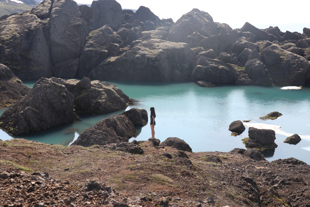
Table of contents
- 1. Múlagljúfur Canyon
- 2. Landmannalaugar
- 3. Kerlingarfjöll
- 4. Stórurð
- 5. Glymur Waterfall Hike
- 6. Reykjadalur Hot Spring Thermal River
- Important Things To Pack
1. Múlagljúfur Canyon
To get to Múlagljúfur Canyon, enter the coordinates N 63.993021°; W 16.436285°.
Múlagljúfur Canyon is a hike in the south of Iceland. It is easily accessible by the ring road. You will be able to see a canyon covered in bright green moss, while having waterfalls coming out of random parts of the canyon. This makes the location look like a magical scene from Jurassic Park.
The trail was well marked. I recommend reaching the end of the hike because the views at the end are as incredible. However, many people also decide to stop the hike once they see the canyon, which is shown in the picture below. The information below on the hike is for the complete hike, which is what we did.
- Distance: 6.5 km
- Elevation gain: 450 m
- Duration: 3 hours
- Type: Out and back
- Difficulty: Moderate
- Trail name: N/A because there is only one trail
- River crossings: No

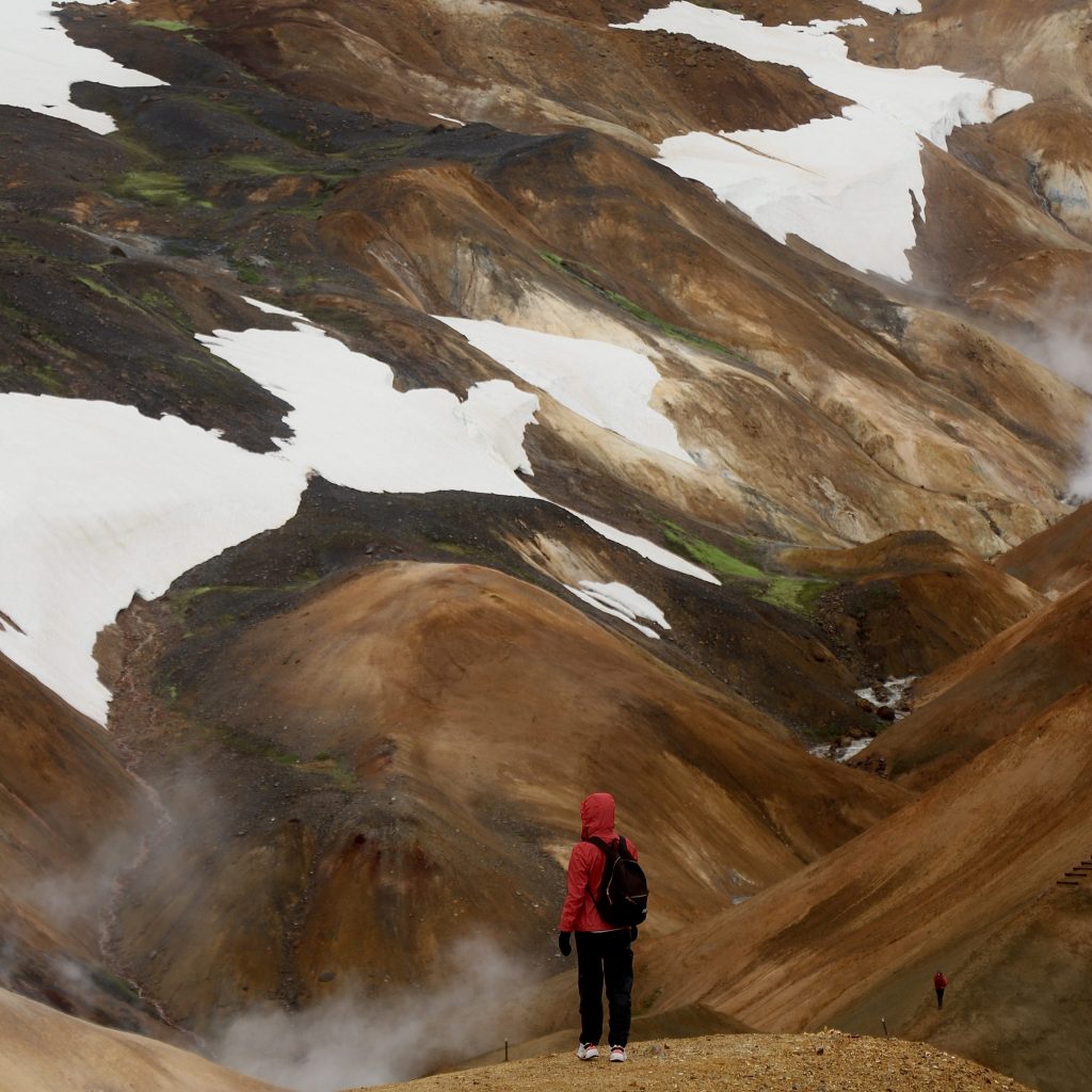
2. Landmannalaugar
To get to Landmannalaugar, you will need a 4×4 because you will be driving on F-roads. The least challenging way to get there is by driving through F208 North. This route also does not have any mandatory river crossings. Although there is one big river crossing at the end, almost everybody parks their vehicle before the river crossing. There is a parking lot designated for it. You can then cross the river by foot with the help of a man made wooden bridge.
Landmannalaugar is one of those places that completely blows your mind because of the interesting colours of the mountains. Even though we explored Landmannalaugar on a very rainy and cloudy day, it did not take away the fact that we were blown away by this location. I highly recommend visiting, rain or shine.
There are many different trails that you can take. We hike two different trails, Blahnúkúr and Brennisteinsalda. I highly recommend these trails because you get to see the most out of your time here. The trails were well marked.
- Distance: 14.5 km
- Elevation gain: 840 m
- Duration: 5 hours
- Type: Loop
- Difficulty: Hard
- Trail name: Blahnúkúr and Brennisteinsalda
- River crossings: Yes (2 for Brennisteinsalda)
For this day’s itinerary but with a tour, you can book here! Among the many things included, they offer pick up from Reykjavik for those who do not feel comfortable on F-roads.

3. Kerlingarfjöll
Stop get to Kerlingarjöll, starting from Gullfoss, make your way onto road 35 and head north. On Google Maps, it will show that it is F35, but it is not considered an F road anymore. After driving on road 35 for around an hour, turn right on F347. Drive on F347 until you make it to “Hveradalir Thermal Area Parking.”
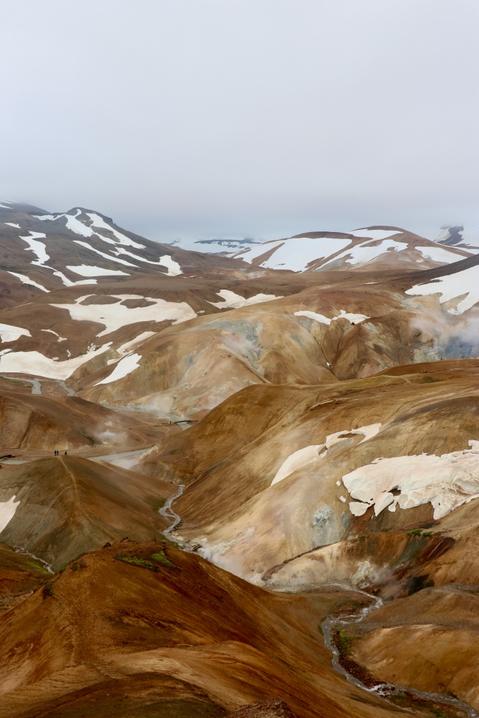
Kerlingarfjöll is a mountain range situated in a geothermal area. You will see colourful mountains with steam coming from every corner.
There are specific trails around Kerlingarfjöll, but you can also decide to just wander for a few hours in Hveradallir Thermal Area without sticking to a specific trail.
- Distance: 4.7 km
- Elevation gain: 380 m
- Duration: 2 hours
- Type: Loop
- Difficulty: Moderate
- Trail name: N/A
- River crossings: No
If you are interested in visiting Kerlingarfjöll with a tour, I highly recommend this tour! They will pick you up in Akureyri and drive you to Hveravellir and Kerlingarfjöll. The route that they take is a route that is not easy to drive on for everyone, so booking with them can help you save a lot of hassle.
4. Stórurð
Depending on the trail that you would like to hike to get to Stórurð, you will need to park at a different spot. We hiked the Njardvik trail. The parking for that is called “Njardvik (Storud Trail Head)” on Google Maps.
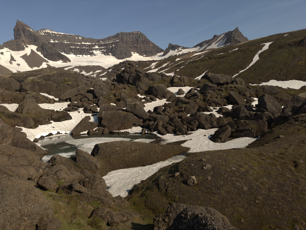
Stórurð is located in the east of Iceland and is still a gem that is yet to be discovered by too many people. On our hike, we only saw around 5 people. This hike is also very diverse. You will do small river crossings, walk on snow, see big mountains, reach a gorgeous blue lagoon, and maybe even cross by a few sheep.
- Distance: 12.1 km
- Elevation gain: 700 m
- Duration: 6 hours
- Type: Out and back
- Difficulty: Hard
- Trail name: Njardvik trail
- River crossings: Yes (very small where you barely get your shoes wet)
5. Glymur Waterfall Hike
To get to the beginning of the hike, search “Botnsá and Glymur Parking” on Google Maps. Once you arrive, you will see that there are two paths: one on the left and one on the right. I recommend going with the one on the right. If you decide to do the loop, you will anyways come down from the left path.
Glymur is a beautiful and challenging hike. The river crossings in this hike are the most challenging out of all the hikes in this guide, but do not let this scare you away! The first river crossing is simple and at the beginning of the hike. There is a rope that will support you when you cross. The second river crossing is at the middle of the hike. This crossing is longer but very doable if you evaluate your surroundings before crossing.
- Distance: 7.9 km
- Elevation gain: 460 m
- Duration: 4 hours
- Type: Loop (you can also do it out and back)
- Difficulty: Hard
- Trail name: N/A because there is only one trail
- River crossings: Yes (2)

6. Reykjadalur Hot Spring Thermal River
The Reykjadalur Hot Spring hike is very easy to follow. Most of the path is on a very obvious road. What’s lovely about this hike is that you are rewarded with a natural hot spring where you can relax in. To get to the start of the hiking trail, search “Reykjadalur Hot Spring Thermal River” on Google Maps.
Once you reach the hot spring, you will see that there is a man made bridge. From there, you can descend into the hot spring. Make sure to test out the water before entering because you do not want to burn yourself.
- Distance: 8.05 km
- Elevation gain: 340 m
- Duration: 2 hours
- Type: Out and back
- Difficulty: Easy
- Trail name: N/A because there is only one trail
- River crossings: No

Important Things To Pack
Here is a short list of important things to pack while you go on your hikes. The linked items are exactly the same items that we also brought with us, if not identical.
- Rainjacket
- Rainpants
- Hiking boot
- Hiking poles
- Water bottle
- Backpack
- Backpack waterproof cover
- Snacks
- Camera
